A Comprehensive Guide to the Srikhand Mahadev Trek
The Shrikhand Mahadev trek is a journey that takes one to the summit of Shrikhand Mahadev (5,227 meters/17,150 ft), which is named after Lord Shiva. The main attraction of this trek is the stunning view of the Himalayan ranges from the Parvati valley. From there, one can observe the Kullu, Jorkandan and Rangrik ranges of Kinnaur, Hansbeshan and other surrounding summits in the southeast of the Satluj river.
The trek can be undertaken by two different routes, one beginning from Nirmand and the other from Arsu. The most popular and well-travelled is the Nirmand-Jaon village option. To reach the base camp, you would have to drive from Shimla to Rampur, crossing the Satluj river and continuing until Jaon Village. This trek can be completed within a span of 5-6 days, including three days of trekking and the full Delhi-to-Delhi journey.
Fascinating Facts about Trekking
The height of the location is 5,227 meters or 17,150 feet.
Trail Characteristics : This is a difficult trek with steep inclines and rough glaciers paths, as well as rocky moraine sections. Those without prior experience with high altitude treks should not attempt this one.
Railway Station : Jaon Village is 170 Km away from Shimla, the closest railway station. Shimla is linked to Kalka by a narrow-gauge line.
Getting to Jaun : From Shimla Inter-State Bus Terminal (ISBT), one can take a bus or hire a cab, and travel 130 km to Rampur. Then, they can take a local bus from Rampur to Nirmand in Kullu, and from there, the last 8 km to Jaun is a kuccha road.
Singhgad or Jaon Village can be used as the base camp.
Brief Travel Plan For Shrikhand Mahadev Trek
Beginning in Jaun, a village in the Kullu district that stands at 6,397 feet, the trek to Holy Shrikhand Mahadev commences. This small settlement is situated along the right bank of Kurpan River, which springs from the base of the Shrikhand Mountain Range. Kurpan is a swift-flowing stream with sparkling water, and in the monsoon it appears to be a wild and dangerous river.
Located in the Himalayan range, Jaun is a small village of about 50 houses and a temple dedicated to Mata Katyayni. The area is approachable from Baagi Pul via a Kuccha road of 8 Kms. The village is surrounded by the picturesque views of mountains, streams, homes and temples, as well as the luscious apple orchards. On a clear day, visitors can also get a glimpse of the holy Shrikhand peak from Jaun. Additionally, it’s the last place to buy some basic necessities for the trek.
You will find the locals of Jaun smiling innocently, welcoming visitors with open arms. Inhabitants of this region are known for their hospitality. To get to know more about the surrounding area, spend time with the locals and learn about the Shrikhand Yatra and how it has become a source of income for the people here.
Heading to Singhgad from Jaon is an undertaking that many take on. The journey often involves making a trek through the hills and valleys of the region. It can be an exciting adventure that many find enjoyable and worthwhile.
Singhgad, located at 6,873 ft., is a 3 km trek away from Jaon. Along the right bank of Kurpan, you will pass through several apple orchards, streamlets, and a village with traditional homes, most of which have two stories. It takes approximately 1 hour to reach Singhgad, as it is a paved path beside the river.
Singhgad is an ideal spot to rest or stay for a while. The location is a holy site and visitors often come to perform rituals during their pilgrimage. Visitors can also visit the temples located here. The area is characterized by its verdant forests and Deodar trees. This is what makes the area renowned for its thick woodlands.
On day one of a journey to Barathi Nala, travelers encountered a rivulet called Kurpan, as pictured here: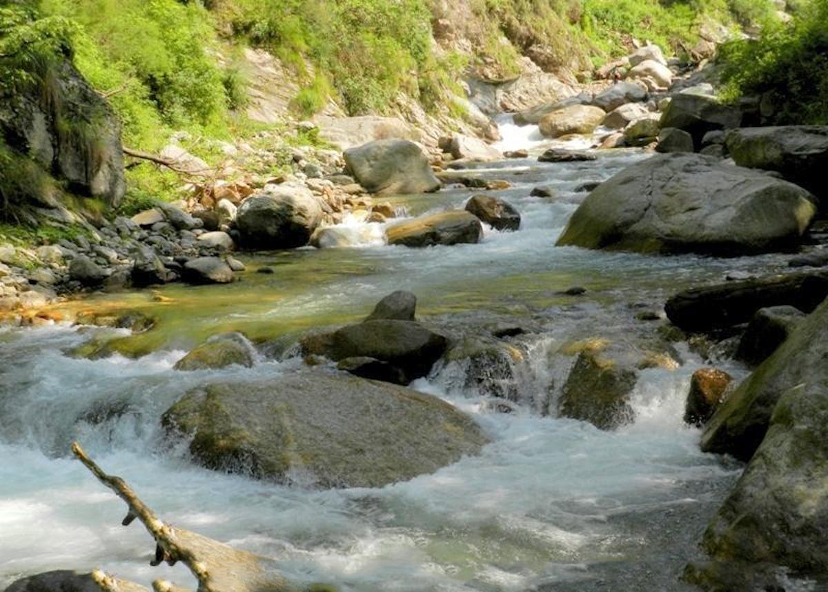
From Singhgad to Thachru – that’s the route one would take.
The next stage of the journey leads to Barathi Nalah, a peak standing at 7,283 ft. This trek of 3 km can be completed within 1.5 hours, and the views along the way are stunning. Part of it involves crossing a wooden bridge made of a Deodar tree, providing an exciting and thrilling experience that brings the adventurers close to nature.
At Barathi Nalah you can take a break before the 6 Km vertical climb of Danda Dhaar up to Thachru. This trek can take up to 6-8 hours and demands a great deal of stamina. You can make rest stops along the route, which passes through the dark deodar forests, where it is impossible to discern anything due to the thickness of the trees. You can however make out the sound of rivers, streams and waterfalls quite clearly. As there is no access to water on the way to Thachru, it is essential to carry enough water to last the journey.
When you are hiking up the hillside, you can observe the varying vegetation and from numerous vistas, the Kullu Himalayas can be viewed. Along the journey, one can come across some large Deodar trees which are many years old. Spectacular birds can be seen on the way to Thachru. Additionally, there are some rocky areas where one can appreciate the scenery of the thick woods and small streams near Danda Dhaar and its surrounding areas.
At an altitude of 11,318 ft, Thachru is the endpoint of the tree line. Herbs and shrubs are the only vegetation in this area. In the evening, the views of the Sarahan and Kotgarh region to the South, Shrikhand peak to the East, and Kullu Himalaya to the West are breathtaking. It is also the ideal spot to spend the night after a 6-8 km climb, as the trek from there to Parvati Baag is gentle and less demanding.
The sacred Thachru, the sacred Kaali Ghat, and the holy Kunsha
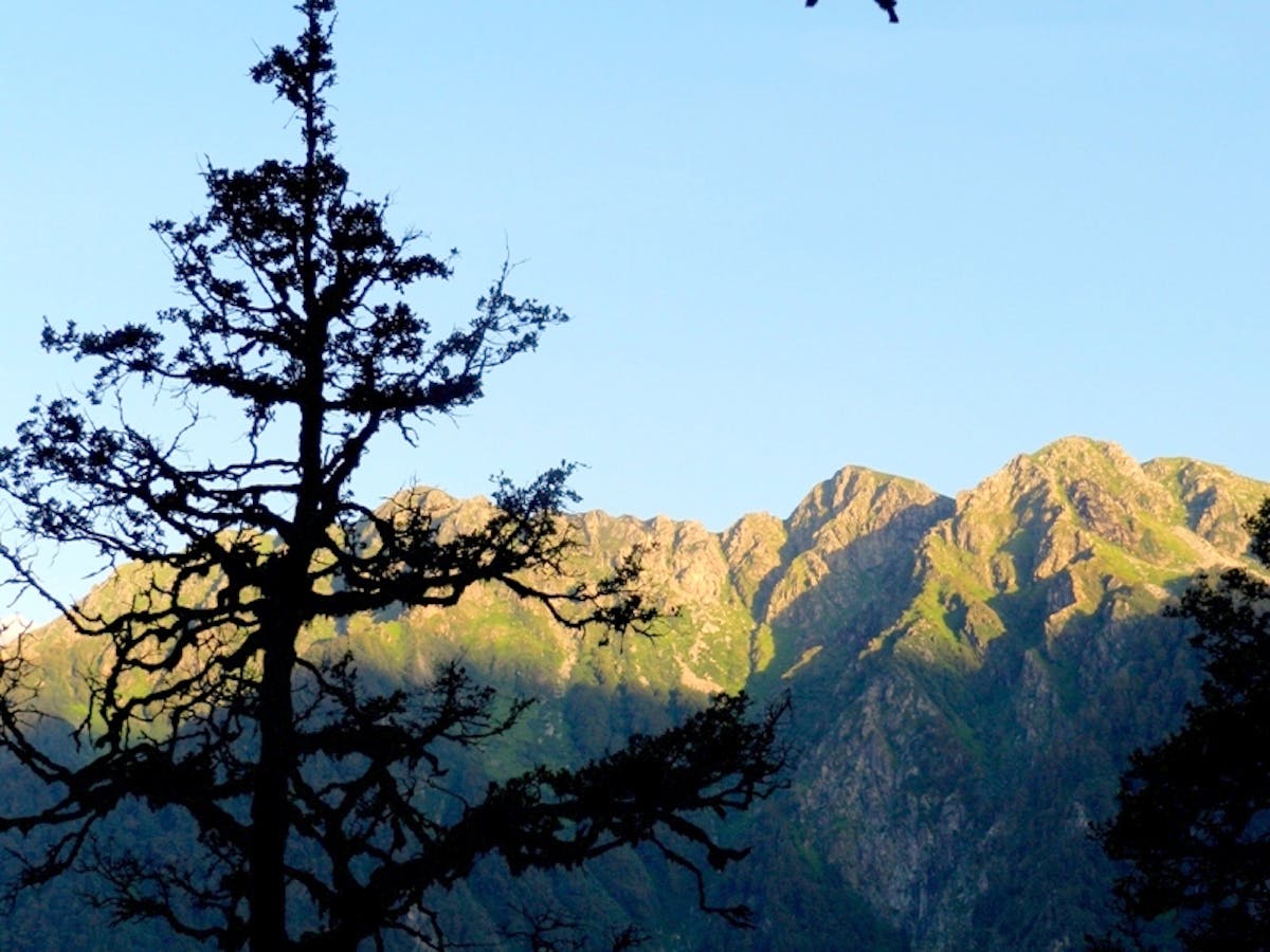
A 3 km straight climb from Taacharu to Kaali Ghat takes around 1.5 hours. On the trek, one can come across some of the rare Himalayan flowers. The path is north-facing and has a deep ditch on one side. After an hour of trekking, an open space full of big rocks appears. This area offers a clear view of the surrounding mountains and one can reach Kaali Ghat in the next 15 minutes. It is situated at 12,778 ft and is the top of Danda Dhaar. The vertical ascent that started at Barathi Nala culminates at Kaali Ghat; giving a 360-degree panoramic view of the Himalayas.
The picture illustrated below offers a view of the mountain ranges from Kali Ghati.
At Kaal Ghati, there is a temple devoted to the Goddess Kali that marks the beginning of the next journey. This trek is a gentle one and will take only half an hour to complete the 1.5 km distance to Bhim Talai. This spot is said to be where one of the Pandava brothers, Bhim, once took his bath. It is situated 11,279 ft. above sea level and is encompassed by tall mountains, grasslands, and little cascades. Shepherds can also be found in this area.
The trek from Bhim Talai to Kunsha, which is a distance of three kilometres, can be completed in 1.5 hours. After traversing a large grassland, the path passes through a glacier that is 500 metres in length and 80 metres in width. Following this, there is a vertical climb through rocky terrain to Kunsha, which stands at 12,746 feet. This spot is surrounded by large waterfalls and stunning natural beauty. Here, one can spend many hours admiring the gorgeous waterfalls, clouds and flowers. It is an ideal place to relax and be re-energized by the surrounding nature.
Beginning at Kunsha and extending to Bheem Dwar, there is a flat track with some slight hills. This 3 kilometer stretch takes an estimated two hours to traverse. The trail is dotted with rare Himalayan blooms and numerous shrubs. This location is similar to the Valley of Flowers in Uttrakhand, with a plethora of unique flowers easily visible. The area is expansive, affording a stunning view of valleys, ravines, towering waterfalls, and many small rivulets. Kunsha valley enchants with its captivating sights, from the clouds, mountains, and snow patches to the pleasant sound of cascading streams. It is a picturesque dreamscape.
After your two-hour journey in the meadow of nature, you come across Bheem Dwar, which is situated at an altitude of 12175 feet. As per the stories, it is believed that during the Pandavas’ exile, they stayed here. Nowadays, this place is referred to as Bheem Dwar and it is a large Bugyal encompassed by a multitude of waterways and glaciers. While en route to Parvati Baag, you have to traverse the largest waterfall of the trek.
The Shrikhand Mahadev Yatra, held each July, has its starting point at Bheem Dwar. Shepherds often take their sheep and goats to graze in the area. There are caves here that provide shelter to pilgrims who need to rest. The stunning beauty of the area has a captivating effect, easily drawing people in and making them want to linger and take in the natural wonders.
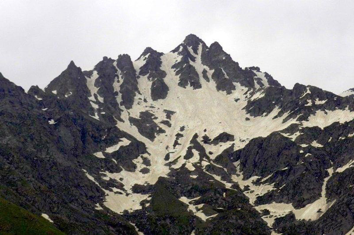
This picture shows the peaks that can be seen from Bheem Dwar.
Located at 13,622 ft, Parvati Baag is just a 3 Km trek from Bheem Dwar and the journey to get there takes around 2 hours. The hike up until the large waterfall is mild, but after crossing it there is a steep 2.5 Km climb to Parvati Baag. It has gained its name due to the legends of Mata Parvati staying in this area. It is a stunning location, abundant with rare flowers from the Himalayas and is particularly renowned for the Brahma Kamal, a flower which can be easily found here. Parvati Baag is situated just beneath the Shrikhand Mountain, and it is said that at night it is possible to touch the sky with your hand.
A journey from Parvati Baag to Nain Sarovar and back can be made. This route can be traveled, with the end point being where it began.
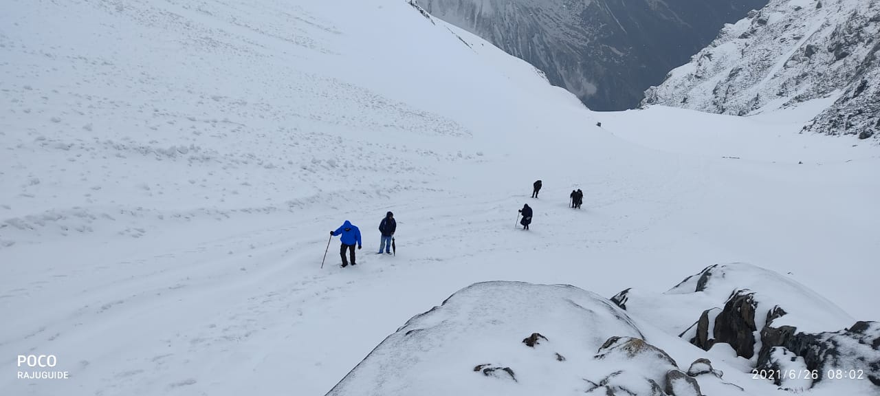
At dawn you must set out heading to the Holy Shrikhand Peak. The last place to find vegetation, such as grass, shrubs and herbs is at Parvati Baag. Moving beyond this location, your path is only moraines and snow. Shrikhand Peak is a mere 6 Km away from Parvati Baag. As you journey to Shrikhand, you will pass through glaciers, streams and stone tunnels.
Heading to Shrikhand Mahadev?
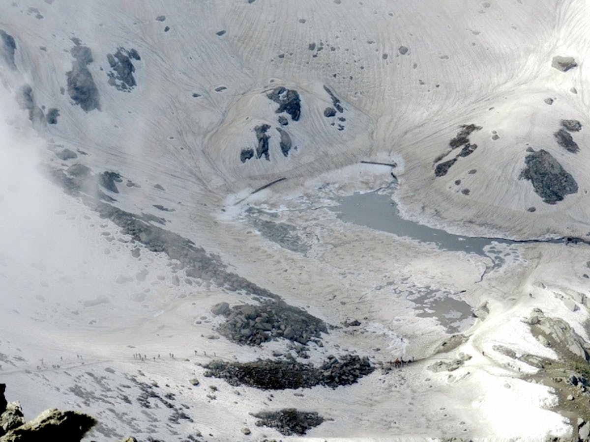
The initial section of the journey to Nain Sarovar Lake is mostly composed of snow and rocks. This lake at 14,527 ft is encompassed by a region of about two football fields and it takes 1.5 hours to get to it. The complete trek to Shrikhand Mahadev is connected with Lord Shiva and Nain Sarovar Lake; it is said that it was formed by the tears of Maa Parvati when she was venerating Lord Shiva.
Maa Parvati is venerated at Nain Sarovar Lake, which is a place of worship. After taking some time to get used to the atmosphere, visitors should return to Parvati Baag.
Backtrack to Nain Sarovar. The climb to Shrikhand is very abrupt and steep from this spot. The initial section of this hike from Nain Sarovar is a glacier of 200 meters. It takes around 45 minutes just to finish this 0.5 kilometer section. It takes a lot of stamina to accomplish this part. Once 45 minutes are spent, you arrive at the peak of a cliff at 14,967 ft. From this point, you can clearly observe the magnificence of Nain Sarovar Lake. Towards Shrikhand, large rocks and glaciers can be seen. If you reach early in the morning, the beauty of Kinnaur Mountains can be viewed from here.
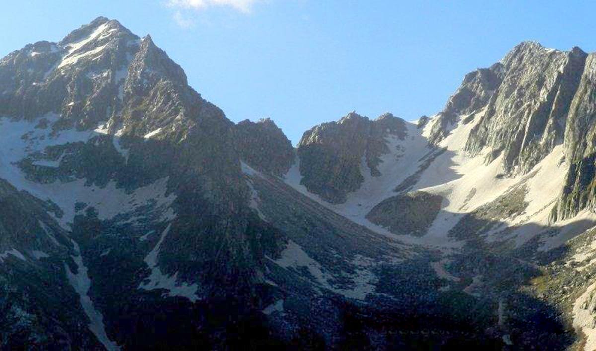
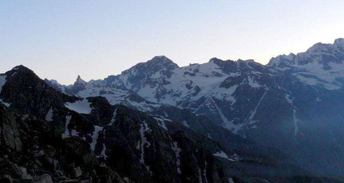
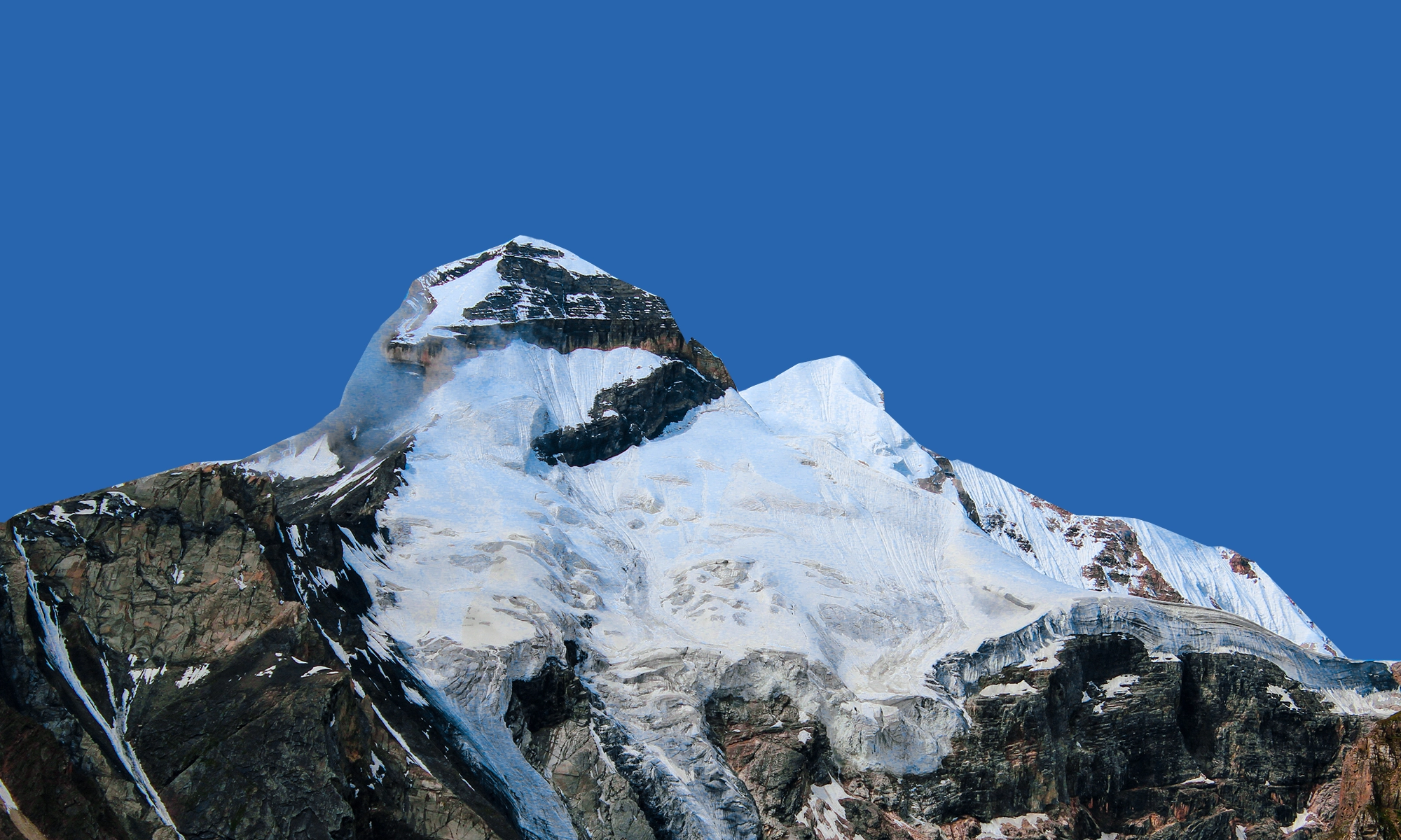
A glimpse of the intertwining mountain ridges can be seen from Shrikhand Mahadev, as presented in the image above. The photo showcases the connected ranges located at this location.
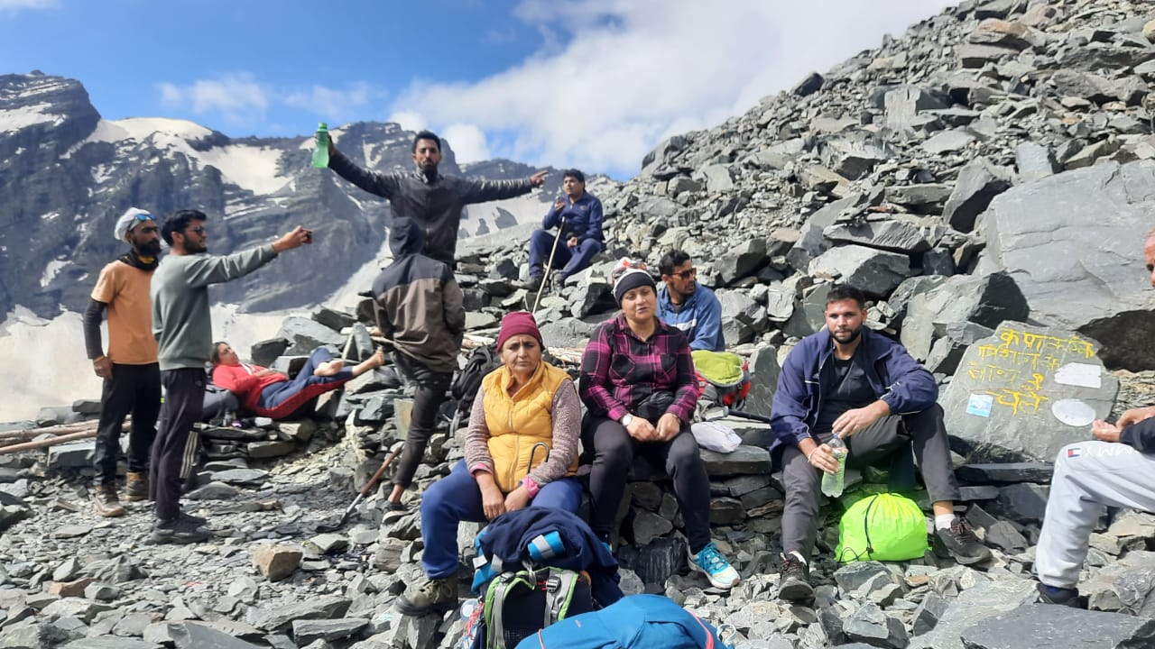
Once you progress further in the hike, you will see snow and moraines in most places. Seven peaks have to be conquered in order to reach the peak of Shrikhand. As the sun rises, you will feel as if you are above the clouds. While making your way to Bheem Bailee, you will cross several glaciers and tunnels made of stones. Bheem Bailee is a holy area dedicated to Bheem, located at an elevation of 15921 ft.
At this place, various marks have been found on stones. Legends speak of Bheem constructing a stairway to Heaven, which was not completed due to the lack of time. By looking at the stones piled on top of each other, one can imagine the stairway. From Bheem Baiee, the holy Shrikhand Shila can be seen. It requires a half hour to reach Shrikhand and one has to go across a vast glacier in order to get there.
At an altitude of 17,150 ft, Shrikhand provides a spectacular view of the Himalayan Mountains from three directions and a captivating sight of Rampur Sarahan and the Shimla hills from the fourth side. Everywhere you go, you can bask in the aroma of nature.
From the summit of Shrikhand Mahadev, an impressive vista can be seen.
From this spot, one can have a view of the Kinnaur Himalaya to one side and the Kullu and Shimla mountains to the other. It is a place where all devotees believe that Lord Shiva is omnipresent.
Going back to Parvati Baag.
For the remaining days until you return to Jaon, the route will be identical to the one you took to get to Parvati Baag.
Completing this Trek
Arriving and departing from Nirmand in Kullu District, Fancha in Shimla District, or Banjar can be done. The Fancha route is the most difficult one to take, while the most secure and common option is the Nirmand, Bagipul, Jaun, Taacharu, Nainser passage. Guides and Porters may be employed from Nirmand or Baagi pul should they be needed. The total distance covered is 32-35 Kms in one direction. The highest elevation is the Shrikhand Peak at 5162 meters. No permits are required.
A Few Key Details
If you are looking to reach the base camp at Jaon Village in the Kullu district, you can take a bus, cab, or your own vehicle and follow the routes from Delhi, Chandigarh, Shimla, and Rampur. The village is 167 km away from Shimla and buses are available from the local bus stand to Jaon, Nirmand, and Rampur. If you would like, you can also book a cab from Kalka taxi union at old ISBT in Shimla for Jaon. The weather is usually cold and windy, with temperatures dropping to below zero at night. It is important to bring warm clothes because snowfall is possible at the Shrikhand peak. The best time to visit is July till August, since the route is open only during these months due to the extreme weather conditions on the Shrikhand peak. The grade of the trek is moderate to difficult with long, steep ridge walks. The one-way trek is 30 km (60 km approx. in total). In June and early July, you will find a lot of firm snow on the trail, while in autumn there are steep sections of rocks to climb. You can usually find tent accommodation along with food (Taacharu and Parvati Bagh) but it can be costly. It is advised to carry your tent if visiting during the pilgrim season to avoid any difficulty in finding a tent.
Gaining Fitness For Shrikhand Mahadev Trek
Getting in shape is a goal that many people strive for. To do this, one must be prepared to make lifestyle changes that involve diet and exercise. Eating healthy and nutritious meals on a regular basis is essential for good health and staying fit. Exercise is also very important and should be done regularly for optimal results. This includes cardio, strength training, and stretching. Planning a workout routine and sticking to it can help to ensure that the individual is staying active and on track with their fitness goals. Additionally, getting plenty of rest and relaxation is key to staying fit, as it helps the body to rest and repair.
It is essential to recognize the significance of avoiding plagiarism while writing. To ensure this, one should reword the text and adjust the structure without changing the context and the meaning. This way, the originality of the writing can be maintained.
Guidelines for becoming prepared for the Srikhand Mahadev Trek
The trek to Srikhand Mahadev is considered an intermediate challenge.
The capacity of one’s cardiovascular system
The ability of the cardiovascular system to sustain extended periods of physical activity is referred to as cardiovascular endurance. This type of endurance is essential for any athlete, as it allows them to perform for an extended period of time.
You will be trekking up to an altitude of 16930 feet for two days, covering a total distance of 26 km. To make the journey comfortable, it is important to have sufficient cardiovascular endurance. It is best to start with jogging, gradually increasing the distance you can cover in 20 minutes, until you are able to run 4 km. Other activities that can help you build up endurance include swimming, cycling and stair climbing with minimal pauses in between.
Capacity to be Strong
The capacity to be strong and resilient, no matter what life throws at you, is something that should be commended. Being tough and able to withstand the challenges that come your way is a valuable skill to have. It can come from an inner strength, from a supportive community, or from a combination of both. Strengthening yourself and your inner resources can help you to stay strong and face any adversity that comes your way.
This is something else you should focus on. It is important to enhance your muscle and core strength. Doing squats can help fortify the muscles in your legs. You can try performing 3 sets of 8 squats. Additionally, planks and crunches can be incorporated into your workouts.
Items to Bring for the Shrikhand Mahadev Trek
Staying organized and prepared for a trek to the Srikhand Mahadev peak is key to enjoying the experience. Here are some items to consider bringing along:
- A sturdy pair of hiking boots
- Appropriate clothing for various temperatures
- A hat and sunscreen
- A good quality backpack
- Water bottles
- A flashlight
- A first aid kit
- A compass
- High energy snacks
- A map of the area
Basics Needed
- Footwear for trekking: You should have a good grip on your shoes as you will encounter many slippery patches on the trail. Sports shoes are not suggested as they may not be comfortable. If you need more guidance.
- Backpack (40-60 litres): A backpack with sturdy straps and a supportive frame is necessary. You should also make sure there is a rain cover to protect your backpack.
It is possible to avoid plagiarism by altering the composition of the text without altering its essential meaning and message. This can be done by rephrasing the words and rearranging the structure of the writing.
The idea that the environment can be threatened by human activities is one that has been around for some time. For many years, people have been conscious of how their activities can have a damaging effect on the surrounding environment. It is now widely accepted that individuals need to be more aware of the impacts of their actions and take steps to reduce their negative environmental impact.
Attire
Garments are one of the most common items worn by people all around the world. They come in a vast variety of styles, colors, and fabrics. Clothing can be used to express an individual’s personality or to make a statement. Whether it is formal or casual, clothing is an essential part of everyday life.
- Be sure to bring two layers of warmth: When camping, especially at higher altitudes, the temperature can dip to 2-6 degrees in the evening. You’ll need at least two lighter layers, such as a fleece and wool, and one more padded jacket for this trek.
- Two pairs of trek pants: You should have one pair of pants for the trek, and an extra one to bring in case the other gets wet. Wear one pair and carry the other.
- Two collared t-shirts: It is important to bring full-sleeved t-shirts to protect your neck and arms from sunburn. Again, wear one and carry the other.
- Thermals (Optional): Those who are more sensitive to the cold can bring thermals to put on at night.
The utilization of technology in the classroom has been found to be advantageous in terms of student learning. Research has indicated that the integration of technology into the educational environment can lead to greater engagement and improved results. Furthermore, it is believed that the use of technology can help to make learning more effective and efficient.
It is possible to eliminate plagiarism by altering the structure of the text without interfering with the context or meaning. This can be done by rephrasing the words, changing the order of the sentences, and making sure the formatting is retained.
Must-Have Additions
- Sunglasses
- Suncap
- Synthetic hand gloves
- Balaclava
- Socks (2 pairs)
- Headlamp/LED torch
- Trekking pole
The use of technology in the classroom has become increasingly commonplace, with more and more educators turning to digital tools to enhance their teaching. This has allowed for the implementation of interactive and engaging lessons, as well as providing students with more opportunities to learn. Furthermore, the use of technology has enabled teachers to access a wider range of resources, making it easier to create comprehensive educational experiences for their students.
It is evident that there is a need for a greater emphasis on the importance of proper nutrition. This is due to the fact that it is an integral component of overall health and wellbeing. By taking the time to focus on the quality of the food we consume, we can ensure that we are providing our bodies with the nutrients it needs to thrive. Doing so can help to prevent a number of health issues and also enhance our quality of life.
Additional People
- Daypack (20 litres): If you are not wearing your larger backpack, you will require a smaller one to carry water, a medical kit and some snacks.
- Toiletries: (Including sunscreen, moisturiser, a light towel, lip balm, toilet paper, toothbrush and toothpaste)
- Cutlery: It is necessary to bring a spoon, coffee mug and lunch box for hygienic reasons.
- Two water bottles: Each should be one litre in size.
- Plastic covers: Use plastic bags for organizing items when packing and bring some extra for wet clothing.
The way to avoid plagiarism is to alter the structure of the text without compromising its meaning or context. This can be done by rewording the content and maintaining the same idea.
The notion that technology is playing a bigger role in the modern world is an idea that many people agree upon. It is becoming increasingly clear that technology is becoming a larger part of our lives, affecting nearly every aspect of our day-to-day existence. Many individuals recognize that tech is having a profound influence on our societies and cultures, and its impact will only continue to grow.
A Requirement of a Personal Medical Kit
- Ten tablets of Diamox for preventing AMS
- Six Crocin tablets for fever
- Avomine in a quantity of four to combat motion sickness
- Four Avil 25mg tablets for allergies
- Four Combiflam tablets for pain relief
- Six Disprin tablets for headaches
- Six Norflox TZ and Lomofen tablets for diarrhoea
- Ten Digene tablets for acidity
- Ten Omez/Rantadine tablets for antacids
- Three to five meters of Crepe bandage
- A small roll of Gauze
- Ten Band-aid strips
- One small roll of Cotton
- Ten packets of ORS
- An antiseptic cream such as Betadine
- A Moov spray for aches and sprains
The use of technology has become increasingly ubiquitous in our lives, making it an integral part of our day-to-day activities. Today, it is hard to imagine a life without tech, as it has become a staple in almost every aspect of our lives. From communication to entertainment, the role of technology has become indispensable.
It is possible to reduce the amount of plagiarism in a text by altering its structure without compromising the context and the intention behind the words. By doing so, the same meaning is conveyed while revising the text in such a way that it does not match the original text.
 "
"
 "
"
 "
"
 "
"